


Imray C18 Western Approaches to the English Channel & Biscay Charts
£25.95Including VAT
- Article number:
- EA0891-AF-35
- SKU:
- YOT0214
Order by 1pm for Next Working Day Delivery
Available for immediate collection in-store.
Fast Delivery
Fast & Fully Trackable As StandardExtended Returns
Return up to 90 days after purchase.Bricks & Mortar Shop
One Of The Largest - Come And See Us - We're Not Just OnlineCustomer Service Guaranteed
Established in 1991 & Trusted By Thousands For Over 30 years.
Product Description
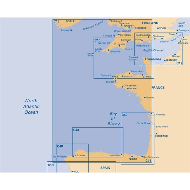
A passage chart of the Western approaches to the English Channel and the Bay of Biscay. The chart has been updated throughout using the latest known depths, buoyage, areas and limits.
The charts are waterproof and folded in a plastic wallet.
Printed and corrected to March 2021.
Sheet Size: 787 x 1118mm.
Areas Covered:
Western section of Bay of Biscay, showing Falmouth to Ushant and NW corner of Spain from Gijon to Vigo. Larger scale plans of Approaches to Vigo, and La Coruna.
Reviews
0 reviews